


Series 23 - Oversize Material 1938-1984
|
Home Provenance Series List Index Search |
| Date Range | 1938 - 1984 |
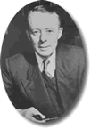
| Provenance | Edwin Sherbon Hills |
| Description | Oversized material including illustrations, photographs and maps, particularly relating to The Physiography of Victoria, the relief model of Australia, Volcanism and contours. |
Inventory Listing
| 23-1 |
Year Planners
|
|
ESH's University of Melbourne Year Planners for the years 1977 to 1984. These are wall calendars, heavily annotated with details of meetings, social engagements and other reminders. Creator Edwin Sherbon HillsDate range 1977 - 1984 Quantity 0.4 cm, Inventory Identifier 23-1 Box Number os Series 23 |
|
| 23-2 |
Physiography of Victoria - illustrations
|
|
Maps and diagrams used to illustrate Physiography of Victoria (from Series 13). Most are numbered, many with notes on placement in text. Also includes panoramic photograph of Tower Hill. Creator Edwin Sherbon HillsDate range 1964 - 1970, maps, otherwise undated Quantity 0.5 cm, Inventory Identifier 23-2 Box Number os Series 23 |
|
| 23-3 |
Physiography of Victoria - illustrations
|
|
Two maps of Victoria drawn on tracing paper, as well as a large aerial photograph with an area masked for reproduction, used as illustrations for Physiography of Victoria (from Series 13). All are numbered, with notes on reproduction and placement in text. Photograph is labelled 'Not needed, has been replaced'. Creator Edwin Sherbon HillsDate range no date Quantity 0.2 cm, Inventory Identifier 23-3 Box Number os Series 23 |
|
| 23-4 |
Physiography of Victoria - illustrations
|
|
Maps and photographs used to illustrate Physiography of Victoria (from Series 13). Includes: endpaper maps on pasteboard; large (41cm x 56cm) photograph and dyeline of Leviathan Rock, Buffalo Plateau. Illustrations are numbered, with notes on reproduction and placement in text. Creator Edwin Sherbon HillsDate range no date Quantity 0.5 cm, Inventory Identifier 23-4 Box Number os Series 23 |
|
| 23-5 |
Arid Lands - illustrations
|
|
Maps and diagrams used to illustrate Arid Lands (from Series 16). All are numbered, some with labels, most with notes on placement in text. Creator Edwin Sherbon HillsDate range no date Quantity 0.8 cm, Inventory Identifier 23-5 Box Number os Series 23 |
|
| 23-6 |
Illustrations - faults (rolled)
|
|
Four assorted illustrations mainly relating to fault lines in South Eastern Australia. Most are unlabelled, one has an illustration number. Creator Edwin Sherbon HillsDate range no date Quantity 0.2 cm, Inventory Identifier 23-6 Box Number os Series 23 |
|
| 23-7 |
Relief model of Australia - negatives
|
|
Large negatives of the entire relief model of Australia, as well as enlargements of particular sections. Some are labelled with enlargement ratio and corresponding scale. Also includes , plate glass negative showing eastern half of relief model. Creator Edwin Sherbon HillsDate range no date Quantity 0.4 cm, Inventory Identifier 23-7 Box Number os Series 23 |
|
| 23-8 |
Relief model of Australia - photographs
|
|
Black and white photographs of varying sizes showing relief model of Australia. Includes prints of entire model, enlargements of particular sections and prints of contours. Many of the photographs are annotated with sketched in lineaments. Also includes: some related maps and photocopies, particularly relating to contours; hand-drawn 'Key to sections of relief model' showing the individual board numbers for the separate sections of the relief model. Creator Edwin Sherbon HillsDate range no date Quantity 0.5 cm, Inventory Identifier 23-8 Box Number os Series 23 |
|
| 23-9 |
Relief model of Australia - Lands Department negatives
|
|
Large negatives (230mm x 230mm) showing complete relief model of Australia, presumably prepared by the Lands Department. Includes prints of south-east corner of relief model. Stored in heavily annotated envelope, labelled 'Lands Dept - Negs. of Model'. Creator Edwin Sherbon HillsDate range no date Quantity 0.3 cm, Inventory Identifier 23-9 Box Number os Series 23 |
|
| 23-10 |
Relief model of Australia - negative of contours
|
|
Large negative of contours of boards 20 and 21 of the relief model of Australia. Creator Edwin Sherbon HillsDate range September 1959 Quantity 0.3 cm, Inventory Identifier 23-10 Box Number os Series 23 |
|
| 23-11 |
Relief model of Australia - photographs of some boards
|
|
Black and white photographs of varying sizes showing particular sections and boards of the relief model of Australia, enlarged to various scales. Creator Edwin Sherbon HillsDate range September 1959 Quantity 0.3 cm, Inventory Identifier 23-11 Box Number os Series 23 |
|
| 23-12 |
Relief model of Australia - photographs of contours
|
|
Black and white photographic copies of contour maps of each individual board of the relief model of Australia, reproduced at scale of 1:2,990,000. Board numbers are labelled on back of photographs in pencil. Creator Edwin Sherbon HillsDate range no date Quantity 0.4 cm, Inventory Identifier 23-12 Box Number os Series 23 |
|
| 23-13 |
Relief model of Australia - originals of contours
|
|
Pantographed original drawings of contours for each individual board of the relief model of Australia, at a scale of 1:2.990,000 (following the David Geological Map). Each is labelled with board number. Creator Edwin Sherbon HillsDate range September 1959 Quantity 0.6 cm, Inventory Identifier 23-13 Box Number os Series 23 |
|
| 23-14 |
Relief model of Australia - photographs of contours (rolled)
|
|
Black and white photographic copies of contour maps for boards of the relief map of Australia, mounted in position on five sheets of cardboard. Creator Edwin Sherbon HillsDate range no date Quantity 0.4 cm, Inventory Identifier 23-14 Box Number os Series 23 |
|
| 23-15 |
Relief model of Australia - contours (rolled)
|
|
Reproduction of complete (excepting Tasmania) map of contours from the relief model of Australia. Consists of a number of separate sheets stuck together. Creator Edwin Sherbon HillsDate range no date Quantity 0.1 cm, Inventory Identifier 23-15 Box Number os Series 23 |
|
| 23-16 |
Relief model of Australia - photograph
|
|
Large black and white overhead photograph of the relief model of Australia, superimposed on grid showing latitude and longitude, with neighbouring countries in outline. Creator Edwin Sherbon HillsDate range no date Quantity 0.1 cm, Inventory Identifier 23-16 Box Number os Series 23 |
|
| 23-17 |
Bauxite, South Gippsland - maps
|
|
Hand sketched geological survey maps and sections of bauxite deposits in South Gippsland (see 9/9-9/10). Stored in paper annotated 'Prof Hills from G. Bell / Many thanks!'. Creator Edwin Sherbon HillsDate range no date Quantity 0.4 cm, Inventory Identifier 23-17 Box Number os Series 23 |
|
| 23-18 |
Volcanism - maps of South Eastern Australia
|
|
Three maps of South-Eastern Australia, one original and two copies, showing locations of volcanoes. Original is labelled 'Volcanoes of S.E. Aust.', copies show volcanoes with scoria/tuff and volcanoes largely of lava. Creator Edwin Sherbon HillsDate range no date Quantity 0.1 cm, Inventory Identifier 23-18 Box Number os Series 23 |
|
| 23-19 |
Volcanism and Basalts - maps and cross-sections (rolled)
|
|
Maps, diagrams and cross-sections, mostly on tracing paper, relating to volcanism and basalts in South Eastern Australia, particularly Victoria. Includes labelled map of 'Newer Basalt Volcanoes of the Warrnambool-Colac District, Victoria'. Creator Edwin Sherbon HillsDate range no date Quantity 0.1 cm, Inventory Identifier 23-19 Box Number os Series 23 |
|
| 23-20 |
Volcanism - map of Eastern Australia (rolled)
|
|
Large transparency showing contour map of Eastern Australia, together with hand-inked transparent overlay showing volcanic features. Creator Edwin Sherbon HillsDate range no date Quantity 0.1 cm, Inventory Identifier 23-20 Box Number os Series 23 |
|
| 23-21 |
Volcanism - maps of Victoria (rolled)
|
|
Three maps showing volcanic features in Victoria. Includes: 'Post-Miocene Tectonic Movements in Part of the Western Highlands'; 'Distribution of Eruption Points in the Western Highlands'. Maps are annotated with some names and pencilled in lineaments. Creator Edwin Sherbon HillsDate range no date Quantity 0.2 cm, Inventory Identifier 23-21 Box Number os Series 23 |
|
| 23-22 |
Volcanism - maps of Queesland (rolled)
|
|
Original drafts on tracing paper of maps showing volcanic features in sections of Queensland. One is labelled 'Atherton 1:250,000'. Some features are named. Creator Edwin Sherbon HillsDate range no date Quantity 0.1 cm, Inventory Identifier 23-22 Box Number os Series 23 |
|
| 23-23 |
Tectonic map of Australia and New Guinea (rolled)
|
|
Two copies of the tectonic map of Australia and New Guinea, prepared by the Tectonic Map Committee of the Geological Society of Australia. One copy is stamped 'Proof' and has minor annotations. The other copy is heavily annotated with lines inked over for emphasis and lineaments sketched in pencil. Creator Edwin Sherbon HillsDate range 1971 Quantity 0.1 cm, Inventory Identifier 23-23 Box Number os Series 23 |
|
| 23-24 |
Contour map of Australia (rolled)
|
|
Large transparent sheet printed with contour map of Australia showing contours and spot elevations in metres. Also transparent overlay showing contours in feet. Creator Edwin Sherbon HillsDate range no date Quantity 0.1 cm, Inventory Identifier 23-24 Box Number os Series 23 |
|
| 23-25 |
Australia - Geological Boundaries (rolled)
|
|
Copy of map labelled 'Geological Boundaries - Australia, 1:5,000,000' compiled from the various state geological plans. Note pencilled on back reads, 'O'Driscoll - Geological Outlines Map'. Creator Edwin Sherbon HillsDate range no date Quantity 0.1 cm, Inventory Identifier 23-25 Box Number os Series 23 |
|
| 23-26 |
Australia - contours and lineaments (rolled)
|
|
Original drafts on tracing paper of maps of Australia. Includes: one outline map; one contour map, marked in feet and metres; map copied from contour map showing structures and lineaments. Creator Edwin Sherbon HillsDate range no date Quantity 0.1 cm, Inventory Identifier 23-26 Box Number os Series 23 |
|
| 23-27 |
Australia - basins etc. (rolled)
|
|
Very large original, retouched draft on tracing paper of map of Australia showing some contours and major landforms, particularly basins. Labelled in pencil 'Basins etc.'. Creator Edwin Sherbon HillsDate range no date Quantity 0.1 cm, Inventory Identifier 23-27 Box Number os Series 23 |
|
| 23-28 |
Australia - topographic (rolled)
|
|
Original draft on tracing paper of a topographic map of Australia, divided into labelled regions and heavily annotated and shaded in pencil. Creator Edwin Sherbon HillsDate range no date Quantity 0.1 cm, Inventory Identifier 23-28 Box Number os Series 23 |
|
| 23-29 |
Australia - contours (rolled)
|
|
Original on transparent film, in two halves, of detailed contour map of Australia, including the continental shelf. Includes key to coloured contours. Creator Edwin Sherbon HillsDate range no date Quantity 0.1 cm, Inventory Identifier 23-29 Box Number os Series 23 |
|
| 23-30 |
Australia - Gravity Map (rolled)
|
|
Gravity Map of Australia, published by the Bureau of Mineral Resources, Geology and Geophysics. Annotated with lineaments, sketched in pencil. Creator Edwin Sherbon HillsDate range 1976 Quantity 0.1 cm, Inventory Identifier 23-30 Box Number os Series 23 |
|
| 23-31 |
Australia - topographic (rolled)
|
|
Topographic map of Australia, published by the Division of National Mapping. Annotated in pencil with sketched-in lineaments and some names. Some contours inked to highlight. Creator Edwin Sherbon HillsDate range 1969 Quantity 0.1 cm, Inventory Identifier 23-31 Box Number os Series 23 |
|
| 23-32 |
Eastern Australia - contours, basins etc. (rolled)
|
|
Original draft on tracing paper of Eastern Australia showing some contours and major landforms, many labelled, such as basins, lineaments etc.. Creator Edwin Sherbon HillsDate range no date Quantity 0.1 cm, Inventory Identifier 23-32 Box Number os Series 23 |
|
| 23-33 |
Topographic map of North Western Victoria
|
|
Topographic map of North Western Victoria printed on cloth, from an original by ESH. Map is annotated in ink with lines showing 'Air Route, March 14, 1939', presumably relating to aerial photography flights. Creator Edwin Sherbon HillsDate range 1938 - 1939 Quantity 0.1 cm, Inventory Identifier 23-33 Box Number os Series 23 |
|
| 23-34 |
Barkly Tablelands and Lake Woods (rolled)
|
|
Original draft in pencil and ink on tracing paper of topographic map of Barkly Tablelands and Lake Woods. Shows contours, some spot heights and rivers. Creator Edwin Sherbon HillsDate range no date Quantity 0.1 cm, Inventory Identifier 23-34 Box Number os Series 23 |
|
| 23-35 |
Torres Strait Islands (rolled)
|
|
Sketch map of Torres Strait Islands with geological notes. Creator Edwin Sherbon HillsDate range no date Quantity 0.1 cm, Inventory Identifier 23-35 Box Number os Series 23 |
|
| 23-36 |
Geological map of Western Australia
|
|
Geological map of Western Australia published by the Western Australian Geological Survey. Includes some annotations in pencil, particularly sketched lineaments. Creator Edwin Sherbon HillsDate range 1973 Quantity 0.1 cm, Inventory Identifier 23-36 Box Number os Series 23 |
|
| 23-37 |
Transparent film - tracings (rolled)
|
|
Two unlabelled sheets of transparent film, lightly marked with inked tracings or shading. Creator Edwin Sherbon HillsDate range no date Quantity 0.1 cm, Inventory Identifier 23-37 Box Number os Series 23 |
|
| 23-38 |
Aligarh Muslim University - photograph
|
|
Large mounted black and white group photograph entitled 'Professor E.S. Hills' Lecture Series / Department of Geology / Aligarh Muslim University, Aligarh / November 27-30, 1972'. Also includes mounted typescript copy of 'Welcome address to Professor E. Sherbon Hills F.R.S. of Australia' by Iqtidar Husain Khan (President, Aligarh Muslim University Students' Union). Creator Edwin Sherbon HillsDate range November 1972 Inventory Identifier 23-38 Box Number os Series 23 |
|
Published by the Australian Science and Technology Heritage Centre on AustehcWeb, June 2004
With support from Thomas Baker (Kodak), Alice Baker and Eleanor Shaw Benefactions and The University of Melbourne Listed by Tim Sherratt and Gavan McCarthy HTML edition Ailie Smith Updated 8 November 2007 http://www.austehc.unimelb.edu.au/guides/hill/HILS0023.htm The template for this finding aid is part of the Heritage Documentation Management System |
[ Top of Page | Home | Series | Provenance | Search | Index ] |